
OUTPUTS
SCIENTIFIC PUBLICATIONS
ATLASES
EBBA2 was a key reference work in the most recent European bird atlases, be it for the resulting maps, the underlying data used to produce them or the methods employed. Examples:
Atlas of Breeding Birds of the European Part of Russia (2020)
The atlas for European Russia shows EBBA2 50-km maps alongside the Russian maps, to allow comparison with the European distribution of the species that breed in this huge territory. It also shows the EBBA2 modelled maps, which were cropped for Russia.
Latvian Breeding Bird Atlas (2021)
The field data collected in Latvia to generate the country’s contribution to EBBA2 were used to document changes in the distribution of breeding bird species in Latvia, which were documented in several projects since the 1980s.
Catalan Breeding Bird Atlas (2021)
Within this book, EBBA2 50-km maps were used to show the proportion of the species’ distribution in Catalonia in relation to the overall European context, and EBBA2 methods were applied to calculate an index of change between the three Catalan atlases.
RESEARCH PAPERS
We anticipate a massive use of EBBA2 in research. Its predecessor, EBBA1, was cited in more than 3,000 scientific publications. According to an analysis over more than 20 years of use of EBBA1 data, EBBA2 could be particularly useful for: i) describing for first time the distribution of birds in eastern Europe, ii) showing the modelled distribution of many species at 10-km resolution and iii) analysing changes in distribution since EBBA1.
Xu Y., Laine V. N., Meramo K., Santangeli A., Poosakkannu A., Suominen K. M., Gaultier S., Keller V., Brotons L., Pulliainen A. T., Lilley T. M., Lehikoinen A. 2024. Slow-lived birds and bats carry higher pathogen loads. One Earth 7, 1121–1132. DOI:https://doi.org/10.1016/j.oneear.2024.04.021
Herrando, S., Fraixedas, S., Brotons, L., Martí, D., Staneva, A., Keller, V., Vorísek, P., Burfield, IJ. 2024. Improving national bird population estimates in Europe: insights from comparisons with atlas abundance data. Bird Conservation International 34, DOI 10.1017/S0959270924000054
Marjakangas, EL., Bosco, L., Versluijs, M., Xu, YJ., Santangeli, A., Holopainen, S., Mäkeläinen, S., Herrando, S., Keller, V., Vorísek, P., Brotons, L., Johnston, A., Princé, K., Willis, SG., Aghababyan, K., Ajder, V., Balmer, DE., Bino, T., Boyla, KA., Chodkiewicz, T., del Moral, JC., Mazal, VD., Ferrarini, A., Godinho, C., Gustin, M., Kalyakin, M., Knaus, P., Kuzmenko, T., Lindström, Å., Maxhuni, Q., Molina, B., Nagy, K., Radisic, D., Rajkov, S., Rajkovic, DZ., Raudoniki, L., Sjenicic, J., Stoychev, S., Szép, T., Teufelbauer, N., Ursul, S., van Turnhout, Velevski, M., Vikstrom, T., Wilk, T., Voltzit, O., Oien, IJ., Sudfeldt, C., Gerlach, B., Shimmings, P., Lehikoinen, A. 2023. Ecological barriers mediate spatiotemporal shifts of bird communities at a continental scale. Proceedings of the national academy of sciences of the United States of America 120: C7 https://doi.org/10.1073/pnas.2213330120
Howard, C., Marjakangas, EL., Morán-Ordóñez, A., Milanesi, P., Abuladze, A., Aghababyan, K., Ajder, V., Arkumarev, V., Balmer, DE., Bauer, HG., Beale, CM., Bino, T., Boyla, KA., Burfield, IJ., Burke, B., Caffrey, B., Chodkiewicz, T., Del Moral, JC., Mazal, VD., Fernández, N., Fornasari, L., Gerlach, B., Godinho, C., Herrando, S., Ieronymidou, C., Johnston, A., Jovicevic, M., Kalyakin, M., Keller, V., Knaus, P., Kotrosan, D., Kuzmenko, T., Leitao, D., Lindström, Å., Maxhuni, Q., Mihelic, T., Mikuska, T., Molina, B., Nagy, K., Noble, D., Oien, IJ., Paquet, JY., Pladevall C., Portolou, D., Radisic, D., Rajkov, S., Rajkovic, DZ., Raudonikis, L., Sattler, T., Saveljic, D., Shimmings, P., Sjenicic, J., Stastny, K., Stoychev, S., Strus, I., Sudfeldt, C., Sultanov, E., Szép, T., Teufelbauer, N., Uzunova, D., van Turnhout, CAM., Velevski, M., Vikstrom, T., Vintchevski, A., Voltzit, O., Vorísek, P., Wilk, T., Zurell, D., Brotons, L., Lehikoinen, A., Willis, SG. 2023. Local colonisations and extinctions of European birds are poorly explained by changes in climate suitability. Nature Communications 14, https://doi.org/10.1038/s41467-023-39093-1
Soultan, A., Pavón-Jordán, D., Bradter, U., Sandercock, BK., Hochachka, WM., Johnston, A., Brommer, J., Gaget, E., Keller, V., Knaus, P., Aghababyan, K., Maxhuni, Q., Vintchevski, A., Nagy, K., Raudonikis, L., Balmer, D., Noble, D., Leitao, D., Oien, IJ., Shimmings, P., Sultanov, E., Caffrey, B., Boyla, K., Radisic, D., Lindström, Å., Velevski, M., Pladevall, C., Brotons, L., Stastny K., Rajkovic, DZ., Chodkiewicz, T., Wilk, T., Szép, T., van Turnhout, C., Foppen, R., Burfield, I., Vikstrom, T., Mazal, VD., Eaton, M., Vorisek, P., Lehikoinen, A., Herrando, S., Kuzmenko, T., Bauer, HG., Kalyakin, MV., Voltzit, OV., Sjenicic, J., Pärt, T. 2022. The future distribution of wetland birds breeding in Europe validated against observed changes in distribution. Environmental Research Letters 17. DOI 10.1088/1748-9326/ac4ebe
TECHNICAL REPORTS
EBBA2 could be a very valuable source of information for technical reports aiming at determining patterns of interest for policy and conservation. The EBBA2 data have already been used for single-species management guidelines but also for the diagnosis of the changes observed in the distribution of several species affected by human activities in particular habitats. Examples:
Modelling & mapping of habitat associations and spatial distribution of European Turtle-dove during the breeding season, and recommendation of management options on a landscape scale (2019)
Within this technical report, EBBA2 modelled maps were used to determine a proposal for location of Priority Intervention Areas for European Turtle-dove.
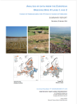
Analysis of data from the European breeding bird atlases 1 and 2. Changes in farmland birds over 30 years of changes in farmlands
This project produced various maps that showed changes in the distribution of farmland birds across Europe at 50-km resolution and at 10-km resolution.
POPULAR ARTICLES
Popular articles could use EBBA2 data to describe patterns of interest for a targeted or general audience. They are particularly important to spread the word about the state of birds at national and international levels. Examples:
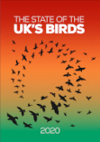
The state of the UK’s birds report (2020)
This is the most updated report of birds in the UK. A few examples of changes in the distribution of species in Europe were taken from EBBA2 to contextualise changes occurring in the UK. In addition, EBBA2 was used to reinforce the international importance of the UK seabirds within the overall European context.
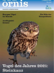
Ornis 1/21 (2021)
Swiss magazine about birds, nature and the environment that reviewed EBBA2, highlighting the influence of changes in climate and agricultural landscapes on birds, as well as the duality between species that can be considered winners or losers in terms of changes since 1980s.
